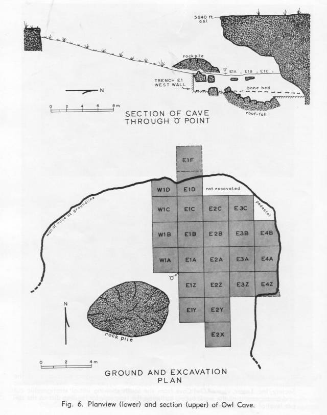
Labels:text | drawing | sketch | diagram OCR: 5240 ft - rock pile EIA CID EIC TRENCH E1 WEST WALL bone bed SECTION OF CAVE roof - fall THROUGH O POINT E1F WID EID not excavated padestol WIC EIC E2C E 3C wall of cave of groundline W1B E18 E 2B E3B E48 WIA EIA E2A E3A E4A 0 E1Z E22 E3Z E4Z N EIY E2Y rock pile E2X O- 2 4m GROUND AND EXCAVATION PLAN Fig. 6. Planview (lower) and section (upper) of Owl Cave.